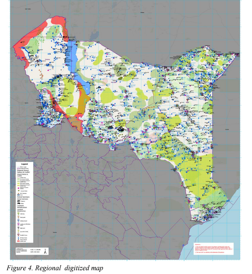
Optimum Geospatial was the GIS Mapping Expert for the Frontier Counties Development Council (FCDC) Rangelands Resource Participatory Mapping Project. The project involved creating basemaps of the existing livestock resources such as markets, grazing lands, water sources, grazing routes, cattle dips, etc. The basemaps were then used to populate new/unmapped resources at participatory mapping seminars across the counties.
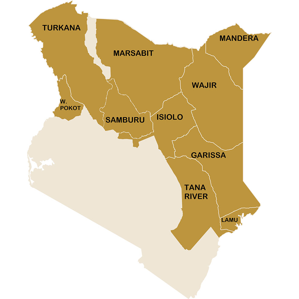
Optimum Geospatial would then proceed to digitize the data from the participatory mapping seminars and develop a comprehensive geodatabase of the rangelands resources within the FCDC counties of Garisa, Isiolo, Lamu, Mandera, Marsabit, Samburu, Tana River, Turkana, Wajir, and West Pokot.
The geodatabse forms a crucial framework for the effective management, preservation, development and utilisation of the rangeland resources, and is a basis for fostering prosperity, peace, and stability in the region.
Client Name |
The Frontier Counties Development Council (FCDC) |
Client Company |
Frontier Surveyors Ltd |
Project Start Date |
2023-09-01 |
Project End Date |
2023-12-31 |
P. O. Box 35828-00200
Nairobi, Kenya.
+254 722 653984
Monday-Friday (9:00 AM - 5:00 PM)
Saturday and Sunday: Off