Aerial/Drone Mapping Services at Optimum Geospatial
At Optimum Geospatial,
we offer advanced aerial mapping services that deliver high-resolution imagery
and precise geospatial data. Our cutting-edge technology and experienced team
ensure accurate and comprehensive mapping solutions for a wide range of industries
and projects.
What is Aerial
Mapping?
Aerial mapping
involves the use of aircraft or drones equipped with high-resolution cameras
and sensors to capture images of the Earth's surface. These images are then
processed and analyzed to create detailed maps and models. Aerial mapping is
essential for applications such as urban planning, agriculture, environmental
monitoring, and infrastructure development. It provides a comprehensive view of
large areas, allowing for efficient data collection and analysis.
Our Services
At Optimum Geospatial,
we provide a wide array of aerial mapping services:
Orthophotography:
Produce high-resolution, geometrically corrected images that provide accurate
representations of the Earth's surface.
LiDAR Mapping: Utilize
laser scanning technology to generate precise 3D models and elevation data.
Aerial Photogrammetry:
Create detailed maps and 3D models from overlapping aerial images.
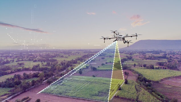
Agricultural Mapping:
Monitor crop health, plan irrigation, and manage agricultural resources with
high-resolution imagery.
Environmental Monitoring:
Track changes in land use, vegetation, and natural resources with detailed
aerial data.
Why Choose Optimum
Geospatial?
Optimum Geospatial is
committed to delivering top-notch aerial mapping services that meet the
specific needs of our clients. Our team of experts utilizes the latest drone
technology and advanced software to provide accurate, high-quality mapping
solutions. We understand the importance of precise aerial data in making
informed decisions and ensuring the success of your projects. Whether you need
detailed orthophotos, 3D models, or environmental monitoring, Optimum
Geospatial is your trusted partner for all aerial mapping needs.
Contact us today to
learn more about how our aerial mapping services can enhance your project and
provide the insights you need to succeed.
P. O. Box 35828-00200
Nairobi, Kenya.
+254 722 653984
Monday-Friday (9:00 AM - 5:00 PM)
Saturday and Sunday: Off